Skip to Main Content
_
Sensor Network
Maps & Radar
Severe Weather
News & Blogs
Mobile Apps
More
Search
close
gps_fixed
gps_fixed
Find Nearest Station
Manage Favorite Cities
Log In
Go Ad Free
account_box
Log in
Go Ad Free
settings
Settings
Sensor Network
Maps & Radar
Severe Weather
News & Blogs
Mobile Apps
Historical Weather
star
Current Weather for
Popular
Cities
San Francisco, CA
55
°
F
Clear
Manhattan, NY
warning
50
°
F
Cloudy
Schiller Park, IL (60176)
48
°
F
Mostly Cloudy
Boston, MA
50
°
F
Cloudy
Houston, TX
74
°
F
Cloudy
St James's, England, United Kingdom
73
°
F
Sunny
Search
close
gps_fixed
gps_fixed
Find Nearest Station
Manage Favorite Cities
settings
--
Feels like
--
--
--
/
--
--
--
--
--
--
--
--
--
--
12AM
6AM
NOON
6PM
12AM
May 10
+0000
May 11
Full Forecast
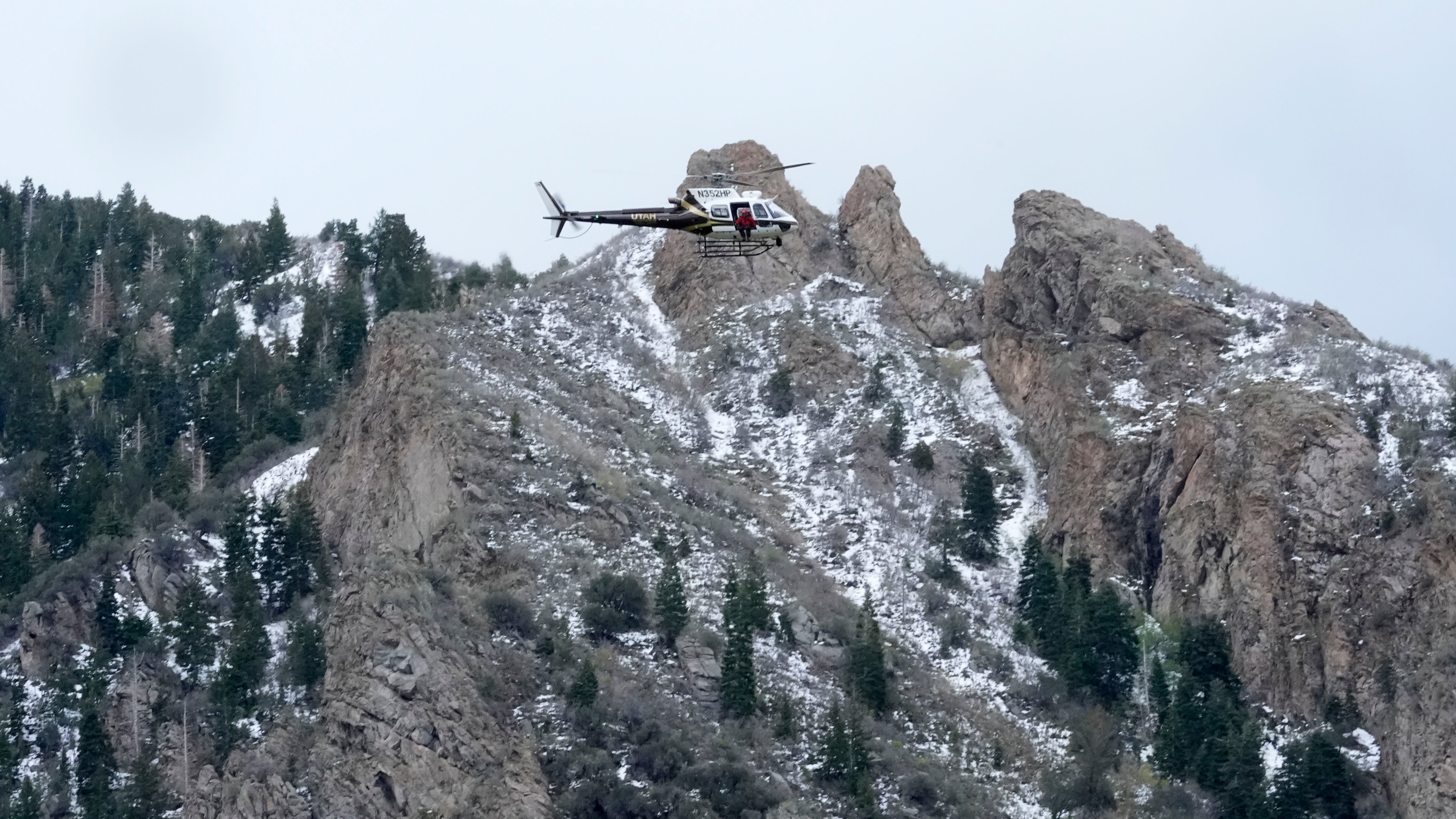
Two Skiers Killed Following Late Spring Snowstorms
Two skiers were killed and one was rescued after an avalanche in the mountains near Salt Lake City.
Two Skiers Killed Following Late Spring Snowstorms
El Niño Could Vanish By June; What That Means For Summer
Here's what the latest outlook says and what it could mean for summer and next winter.
El Niño Could Vanish By June; What That Means For Summer
Goofy Pet Photo Award Finalists Revealed; The Images Are Hilarious
There’s a grinning donkey, some goofy horses, and a lot of funny cats and dogs. Which is your favorite Comedy Pet Photo Award finalist?
Goofy Pet Photo Award Finalists Revealed; The Images Are Hilarious
Tornado Damage In Multiple States; Child Swept Into Storm Drain ‘Needs A Miracle’
A nasty severe weather outbreak that spanned most of the country this week reared its final head in the South and Southeast as Texas braced for hail and tornado threats throughout the evening Thursday.
Tornado Damage In Multiple States; Child Swept Into Storm Drain ‘Needs A Miracle’
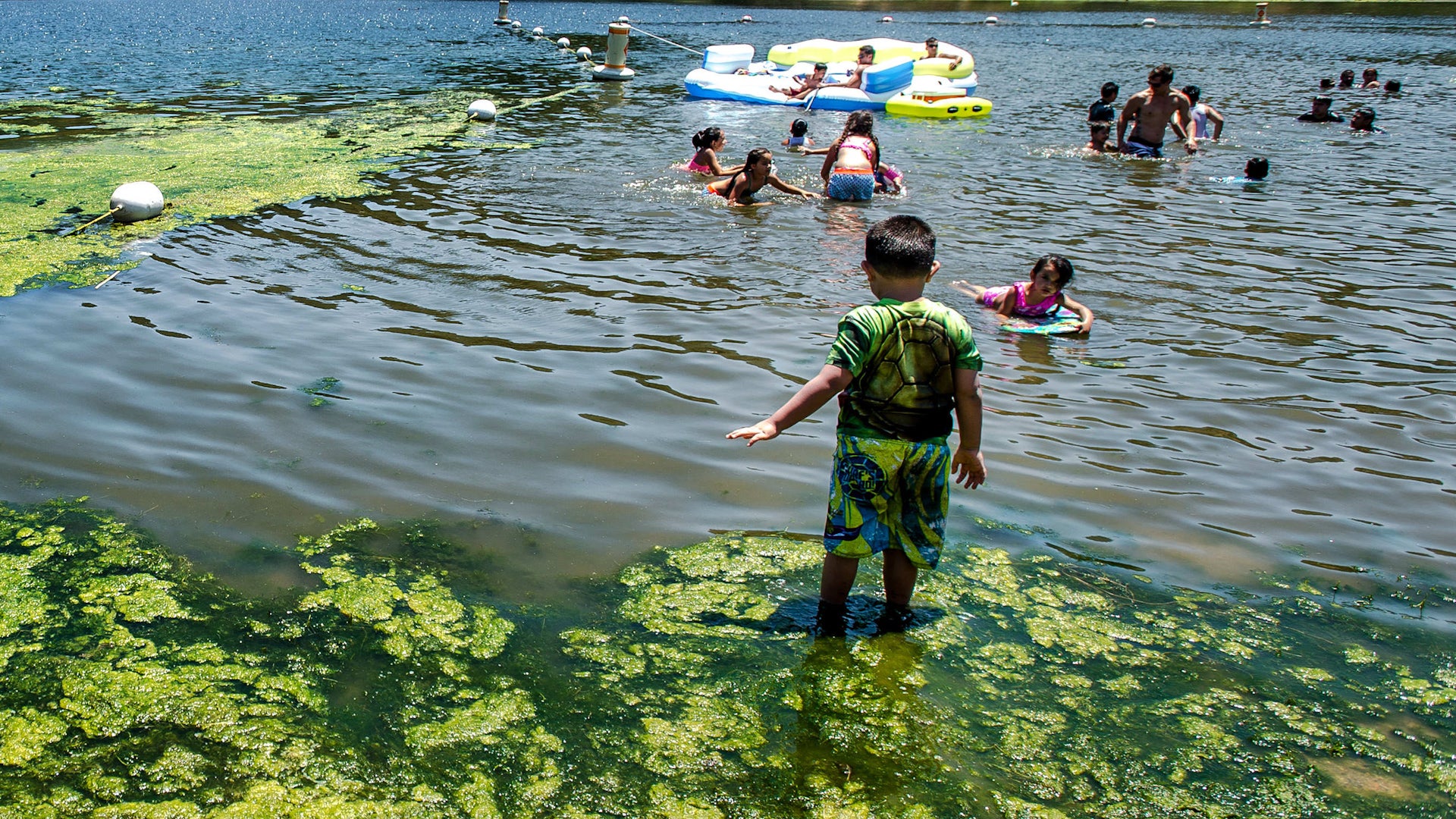
Toxic Algae Found In Popular California Lake
People and their pets have been urged to stay away from a popular lake in Southern California. Watch this video to find out why.
Toxic Algae Found In Popular California Lake
Please enable JavaScript to continue using this application.